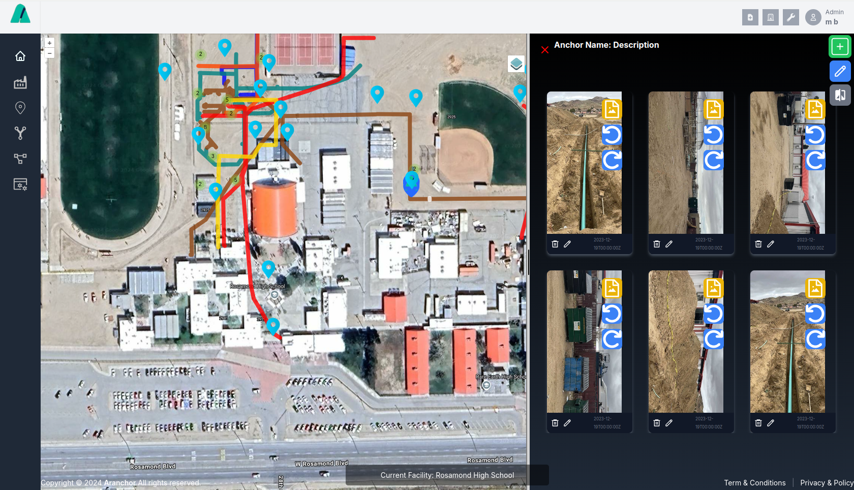
AR Anchor - Revolutionary Construction Documentation Platform

AR Anchor: The cutting-edge Virtual Reality platform that transforms how you manage Construction and Facility Documentation. Experience seamless project oversight like never before.

Register Watch Demo

Revolutionize Your Construction Documentation

Powerful Features to Streamline Your Workflow

Discover how AR Anchor's innovative tools can transform your project management and boost productivity.

REPORTS

AI assisted custom full reports. Simply take a picture and dictate a description. ARA automatically populates your daily with custom logos, photos, embedded video, attachments and more.

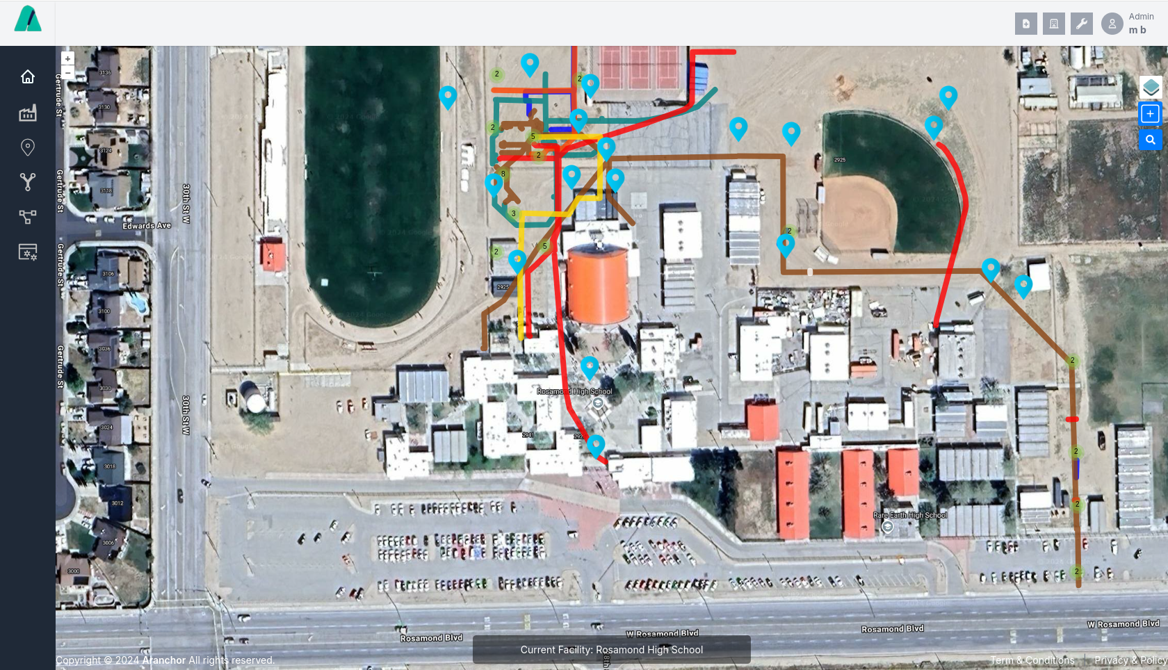
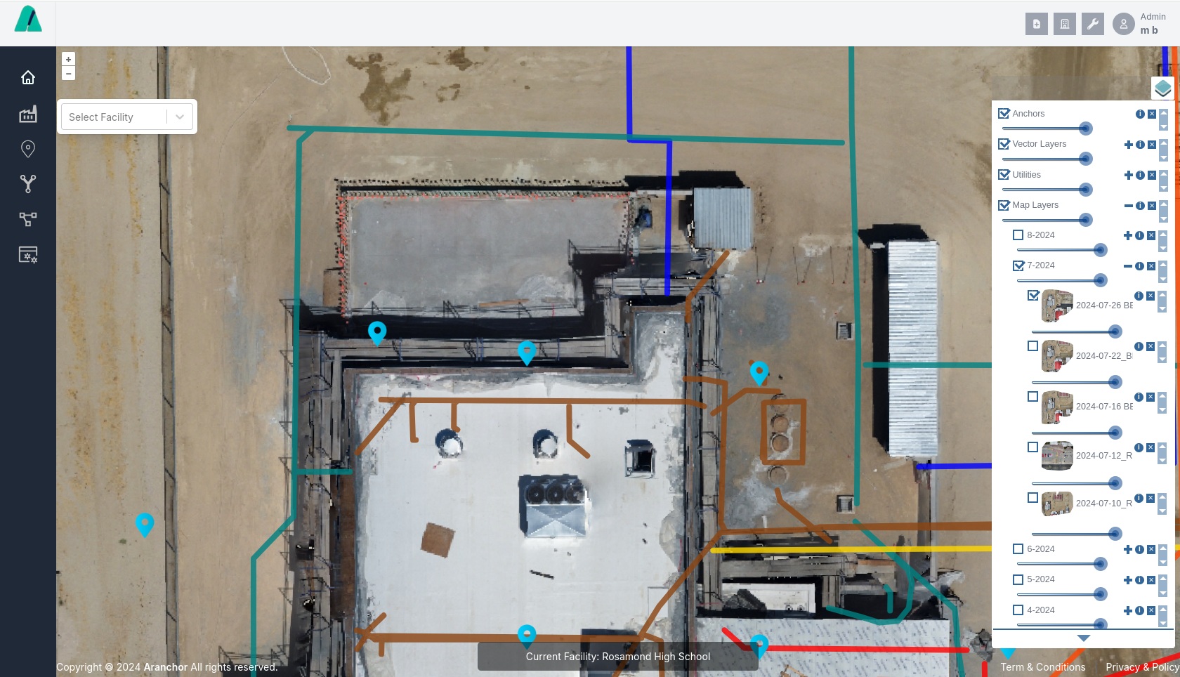
Track job activity, meetings, emails, inspections, Deliveries, Safety, Issues and more all on one platform

GEO PLAN LAYERS

Quickly Geo-reference project plans and create plan layers of facilities & projects over Google satellite, Geo Tiff Layers, and Utility Vectors for a complete picture of your project

Time-Lapse and 3D Nerf Rendering

Track and share progress effortlessly over time with integrated time-lapse sequencing, and create a 3D models of your project from video by simply uploading it to the application.

MAP AND UTILITY LAYERS

Quickly add and access GIS line and point vectors with linked photo mosaics, images, videos, and 360 photos, 3D Models directly from the mobile or desk top application

Cloud-Based Storage

Store and access all your project data securely in the cloud. Collaborate with your team in real-time, from anywhere.

Mobile Compatibility

Use AR Anchor on any device with our mobile app. Monitor progress of your projects, collaborate with your team, and customize access to, projects, facilities, and reports.

How AR Anchor Transforms Your Workflow

Experience a revolutionary approach to construction documentation in four simple steps

1

Capture / Document

Use the ARA mobile app to drop anchors, draw vectors, dimension as-built plans or take pictures / video of your project.

  • 360° panoramic capture
  • Automatic geo-tagging
  • Import KMZ, KML, SHP files from surveys/utility location services
2

Upload

Upload videos to create 3D Models, PDF Plans to create geo referenced layers, or drone captures to create aerial maps.

  • Secure encrypted transfer
  • Automatic categorization
  • Version control
3

Visualize

Visualize your project over time and from any angle by clicking on a layer, or vector. See progress over time with maps, and retrieve as-built information in the field or in the office.

  • Immersive VR experience
  • Interactive 2D/3D maps
  • Time-lapse functionality
4

Collaborate

Harness the resources of your entire team to collect and distribute images, video, drone data, plans, and documents. Produce reports, and store as-builts available all in one place avoiding mistakes, delays, and costs with our simple to use low cost solution.

  • Real-time annotations
  • Issue tracking

Choose Your Perfect Plan

Flexible pricing options to suit your project needs

Starter

FREE

  • 3 Sites / Facilities
  • 3 Projects
  • User Reports
  • One-minute Map Layers
  • Utility Map Layers / Asset Tracking
  • Standard Image/Video Anchors
  • Geo Tagging / Plan Layers
  • 30 Models From Video
  • Cloud Plan Storage
  • 1 GB Space
  • Mobile App
  • 5 Contributors
  • Unlimited Visitors
Register

Advanced

US $6/mo

  • 3 Sites / Facilities
  • 10 Projects
  • User Reports
  • One-minute Map Layers
  • Utility Map Layers / Asset Tracking
  • Custom Image/Video Anchors
  • Geo Tagging / Plan Layers
  • 30 Models From Video
  • Cloud Plan Storage
  • 5 GB Space
  • Mobile App
  • Unlimited Contributors
  • Unlimited Visitors
  • Scheduling / Sharing
Register

Professional

US $30/mo

  • 10 Sites / Facilities
  • Unlimited Projects
  • User Reports
  • One-minute Map Layers
  • Utility Map Layers / Asset Tracking
  • Custom Image/Video Anchors
  • Geo Tagging / Plan Layers
  • 30 Models From Video
  • Cloud Plan Storage
  • 10 GB Space
  • Mobile App
  • Unlimited Contributors
  • Unlimited Visitors
  • Content Embedding / Sharing
Register

Enterprise

Contact Us

  • Unlimited Sites / Facilities
  • Unlimited Projects
  • User Reports / Customized Reports
  • One-minute Map Layers
  • Utility Map Layers / Asset Tracking
  • Custom Image/Video Anchors
  • Geo Tagging / Plan Layers
  • 30 Models From Video
  • Cloud Plan Storage
  • 50 GB Space
  • Mobile App
  • Unlimited Contributors
  • Unlimited Visitors
  • Content Embedding / Sharing
  • API Access / Pro-only Breakdown
Register